Improving protection given to Priority Marine Features outside the Marine Protected Area network
A consultation seeking views on the scope of the project to improve protection given to PMFs outside the MPA network.
The Fishing Footprint
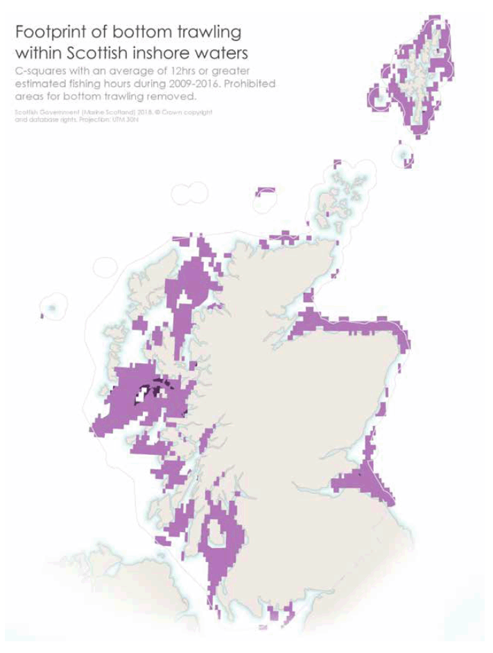
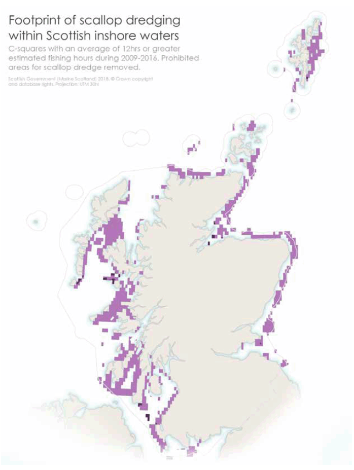
In order to assess the potential interaction between bottom contacting mobile fishing gear and the PMFs it is important to establish the footprint of these activities. To do this we are using a product prepared by ICES for the OSPAR intermediate assessment. This uses Vessel Monitoring System ( VMS) data to provide an annual output made up of grid cells (like pixels). The gridded data estimates the number of fishing hours per method per year in each cell for the years 2009-2016.
For our purposes we have merged the 8 annual layers into a single average layer – one for trawl and seines, and the other for dredges. Within each layer we have then identified the cells in which there are 12 or more hours fishing effort by the whole UK fishing fleet using that method. In 2016 inshore MPA management measures were introduced which affected this footprint, and therefore areas where fishing can no longer take place have been erased.
There are also further inshore measures to be consulted on later this year. Therefore a further indicative version of the footprint has been produced to take account of these. For the purpose of this exercise it assumes that the proposed measures will take effect and therefore any affected parts of the fishing foot print are shown in a darker colour. Clearly should these proposed measures change before implementation then the footprint will be adjusted accordingly.
The VMS data used in this exercise has its limitations. The smallest vessels required to have a VMS system are 12 metres overall length. It is recognised that there are vessels smaller than this using mobile gear in coastal waters. Assistance to identify any areas of missing footprint for these smaller vessels is a key part of this consultation. We would very much like to hear from stakeholders who can provide evidence that can fill any gaps in the footprints. Having a clearly defined footprint will enable comparison between the approaches which are assessed in the Sustainability Appraisal. Figures 4 (seine / trawl) and 5 (dredge) show the average footprints for 2009-2016.
Questions
6. Do you agree that 12 hours per year is a suitable level to define the fishing footprint?
7. Do you have any evidence of fishing activity outwith the footprint, in particular for vessels under 12m in length?

Figure 4. Foot print of bottom contacting trawl gear use 2009-2016.

Figure 5. Foot print of dredge gear use 2009-2016.
Potential management approaches
In order to undertake the Sustainability Appraisal there needs to be a range of potential management approaches that can be assessed to determine potential environmental and economic effects. Testing more than one approach allows the range of potential effects to be identified. For this purpose one management approach has been identified, and the consultation seeks views on reasonable alternatives.
At this point in time we have only devised this approach to be tested in the Sustainability Appraisal. We are not consulting, at this point, on whether this management approach should be implemented. A further consultation will be undertaken for this purpose once the Sustainability Appraisal is completed, and that evidence is available for consideration.
Identified management approach for appraisal
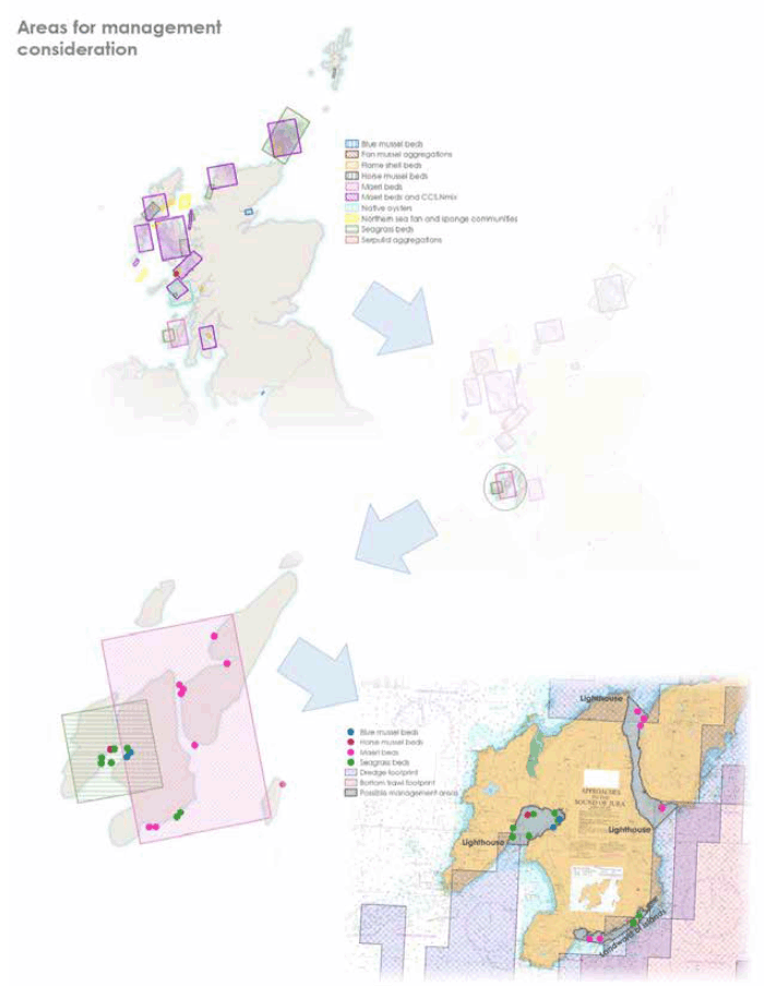
This would adopt a standard approach to defining the extent of potential management measures. This would be done by identifying the areas requiring protection and create zones around them where certain activities would be prohibited. This starts by looking within the areas for management consideration identified in the SNH advice. Zones are then drawn around the records of habitats and species using activity data, environmental factors, and where necessary geographic points of interest. The precautionary principle is applied by zoning off PMFs even where they are not subject to current fishing pressure.
An example of this is shown in Figure 6 using areas for management consideration around Islay and Jura. All examples are shown on Marine Scotland Maps National Marine Plan Interactive ( NMPi). At this stage this is for illustrative purposes only.
Questions
8. Do you have any views on the management approach identified for the appraisal?
9. Are there any other reasonable alternative approaches to management that could be tested in the Sustainability Appraisal?

Figure 6. Example of identifying management zones within areas for management consideration.
Contact
- Marine Conservation team
0131 244 1617
There is a problem
Thanks for your feedback